Wicomico River Stewardship Initiative
  • Home
  • Nature
    • Wildlife >
      • Herps
      • Birds
      • Mammals
      • Native and Invasive Species >
        • Nutria >
          • Nutria on the Middle River
        • Phragmites
      • Food Webs >
        • Upper River
        • Middle River
        • Lower River
    • River Systems >
      • Upper River >
        • Leonard Mill Pond
        • Johnson Pond
        • Schumaker Pond
        • Tony Tank Pond
      • Middle River >
        • Land Use
        • Dredging
        • The Edges
      • Lower River >
        • Bay vs. River
        • Ellis Bay
        • Monie Bay
        • Landscape
    • Water Quality >
      • Wicomico Creekwatchers
  • Things to Do
    • Boating >
      • Access
      • Paddling >
        • Beginners Guide
        • Paddle Trails >
          • Schumaker Pond
          • Rockawalkin Creek
          • Wicomico Creek
          • Cherrybridge Creek
          • Shiles Creek
          • Johnson Pond
          • Leonard Pond
      • Motor Boating
    • Fishing >
      • How To Fish
      • Common Species
      • Places To Fish
      • Bait & Tackle Locations
      • License & Regulations Information
      • Fishing Tournaments
    • Hunting >
      • Ellis Bay WMA >
        • Regulations
        • Map
        • Directions
      • MD State Laws
      • Waterfowl Species
      • What to Bring List
      • Safety Tips
      • Ammo and Supplies Locations
      • Ward Museum
    • Other Shoreline Fun >
      • Dining, Night Life, and Local Spirits
      • Public Parks, Trails, and Exhibits
  • Life on the River
    • History of the River
    • Living on the River >
      • Joan Maloof
      • Sam Gibson
      • Jess Parsons
      • Tyrone Stevenson
      • Lynne Peverley
    • Working the River >
      • John Barnette: A Wicomico Waterman
      • Bobby Bean: Whitehaven Ferry Captain
      • Glen Lay: Port of Salisbury Dock Master
    • Tell us what you do!
  • Get Involved
    • Partners
    • Take Action
    • Hot Topics
  • About Us

Cherrybridge Creek

Picture
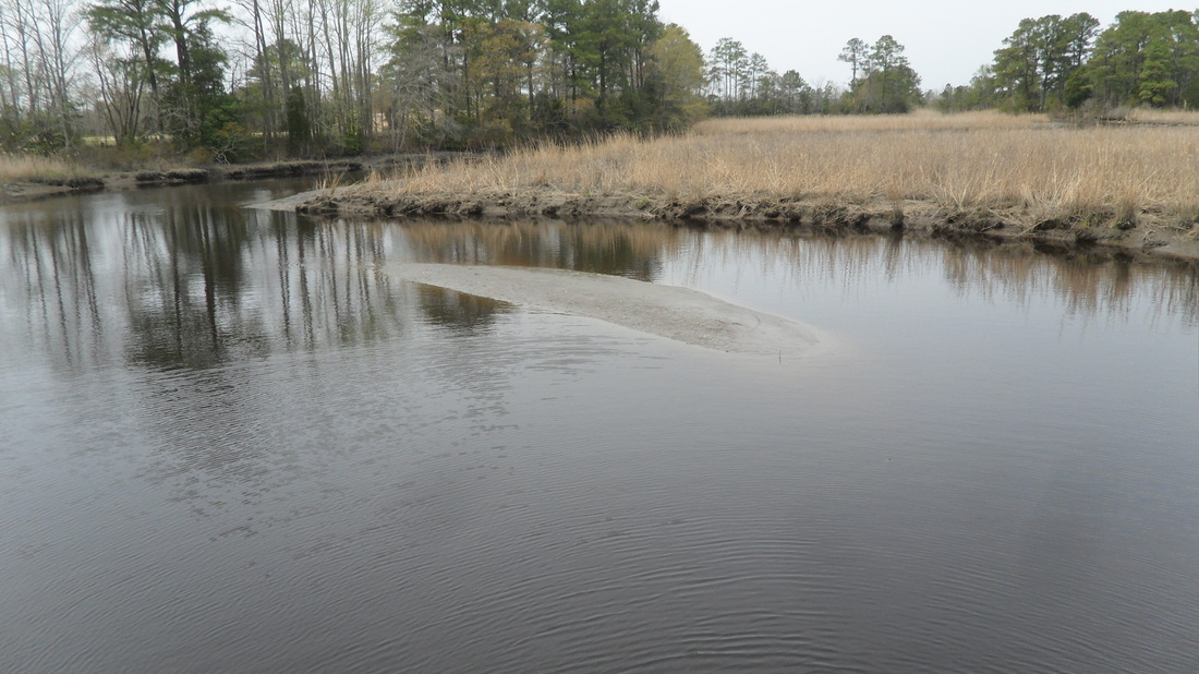
Cherrybridge Creek © Wesley Gould
PictureCherrybridge Creek Paddle
Cherrybridge Creek Paddle
Directions
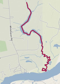
Put in at the bridge just after Green Hill Creek, directly off of Whitehaven Road and paddle downstream through marshland and forested bluffs and pull out in the town of Whitehaven (3 hrs).

Parking: Not much of a shoulder to park on, would be best to get dropped off at bridge and picked up in Whitehaven

Powered by Create your own unique website with customizable templates.